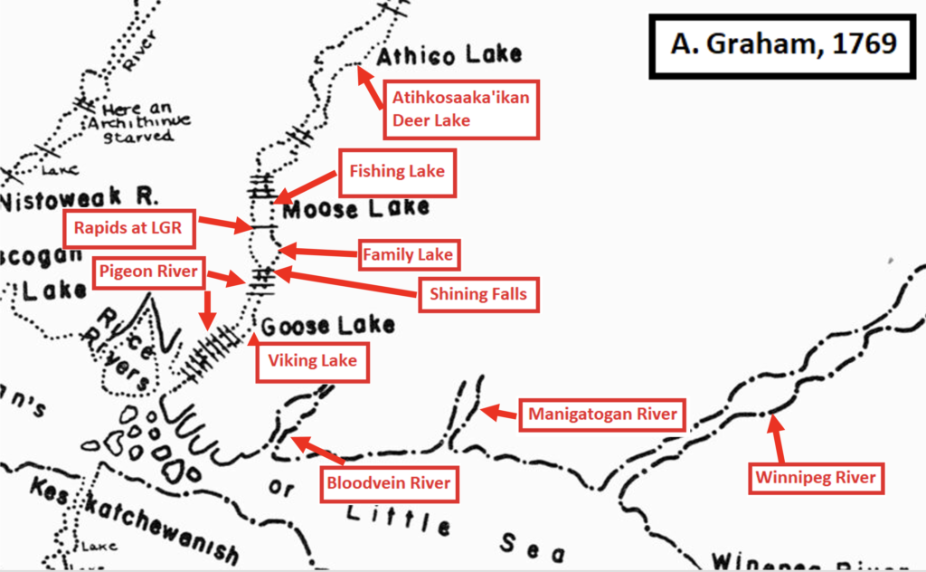
“This is one of the first maps that Hudson’s Bay Company (HBC) made,” said Gerald Neufeld, referring to the map below. “It was likely based on the first journey inland from the Hudson Bay and James Bay posts to look for opportunities to expand the fur trade. Tomison, the Hudson’s Bay Company (HBC) employee from the Severn River post, had not yet found the Berens River and Poplar River.”
“As the years advanced, HBC became more aware of the east side of Lake Winnipeg, and so did their competition, the NorthWest Company out of Montreal.”
Lakes and Rivers Renamed
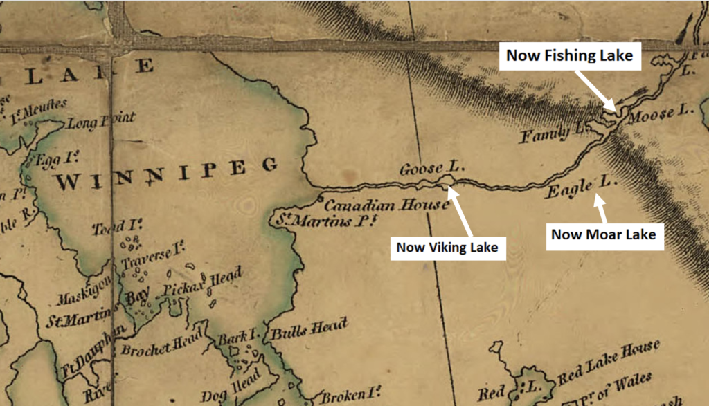
The 1802 Arrowsmith map (below) shows that familiarity with the region had advanced quickly, said Gerald.
From 1923-1926 the region’s lakes and rivers, once bearing Ojibwe names that carried stories and meanings, were renamed. “The Royal Canadian Air Force decided that if they were going to fly their airplanes in this region, they would need proper maps,” said Gerald.
No regard was given to traditional place names of lakes and rivers.
“The problem with their effort from today’s vantage point is that no permissions from Indigenous Peoples were obtained,” Gerald said. “They just went ahead and put names on the lakes and rivers. Some are Indigenous names, others are interpreted names that emulate the Indigenous names and many are names of fallen soldiers, aviators, and land surveyors. They got away with making the changes back in the 1920s, because most people in the region were unable to read or speak English.”
Reclaiming Place Names
Land Guardian Melba Green of Bloodvein River First Nation explains the importance of named places. “Our Elders tell stories about places that were named after the plants and animals who live there, or ancestors who traveled across the land. Some names are based on the rocks or the water that flows there. Water gives life, and the land gives gifts and tools to use and to survive. These names are in our language and remind us to be respectful. They give us important information, like what to expect, or what to watch out for when we’re there.”
That’s why Gerald Neufeld’s work is important and why our communities are creating traditional place names maps that preserve our cultural heritage.
Little Grand Rapids First Nation and Pauingassi First Nation are in the process of creating place names maps to preserve the language, cultural identity, and knowledge of place and travel routes.