• Skip to primary navigation
  • Skip to main content
  • Skip to footer

Pimachiowin Aki

World Heritage Site

  • News
  • Resources
  • Visit
  • Home
  • Donate
  • Contact
  • Facebook
  • Twitter
  • Instagram
  • About Us
    • Pimachiowin Aki Corporation
    • Board of Directors
    • Timeline
    • Communities
      • Bloodvein River First Nation
      • Little Grand Rapids First Nation
      • Pauingassi First Nation
      • Poplar River First Nation
    • Annual Reports
  • Keeping the Land
    • Our Work
    • Cultural Heritage
    • Wildlife and Habitat
    • Sustainable Economies
    • Guardians Program
      • Colin
      • Dennis
      • Melba
    • Education
  • The Land That Gives Life
    • Boreal Forest
    • Calendars
    • Climate
    • Cultural Sites
    • Habitation
    • Harvesting
    • Language
    • Named Places
    • Plants
    • Travel Routes
    • Water
    • Wildfire
    • Wildlife
  • Fast Facts
  • Search

Archives for December 2021

Community-Based Monitoring Project in Poplar River First Nation

December 20, 2021

By Ray Rabliauskas | Photos: Jesse Belle

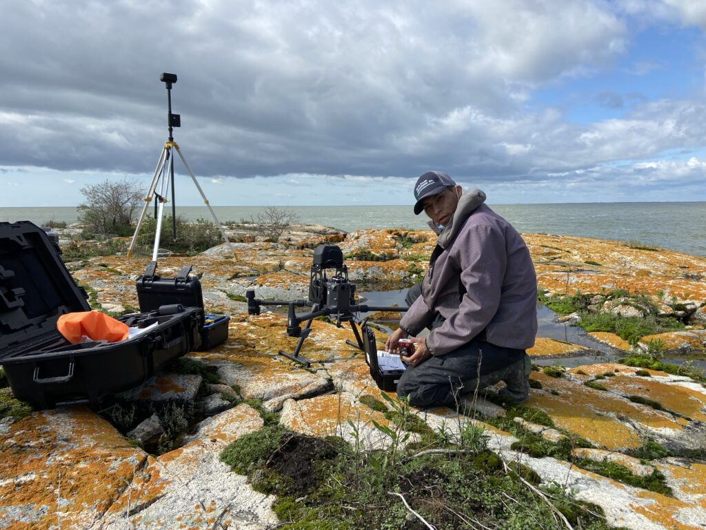
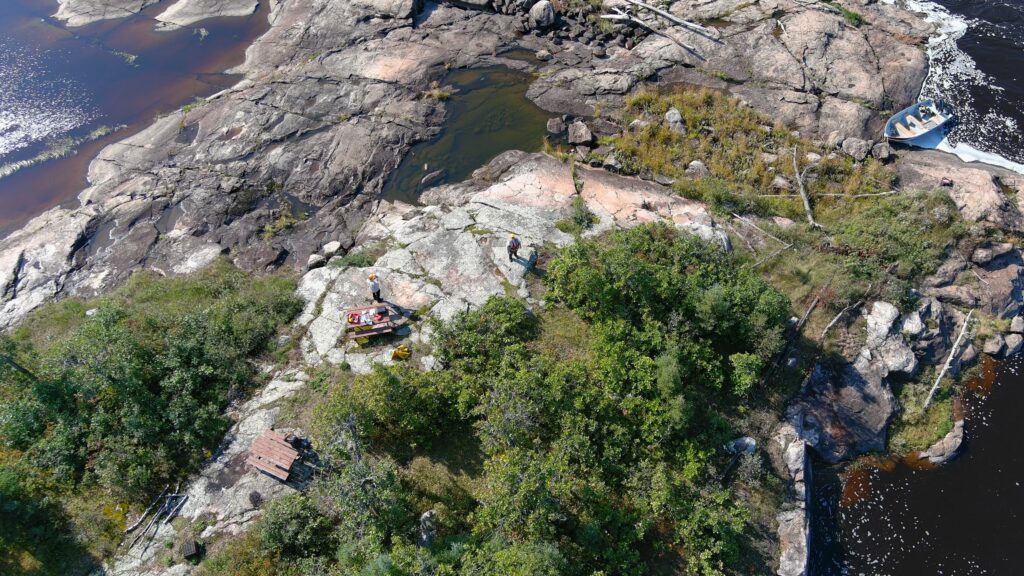
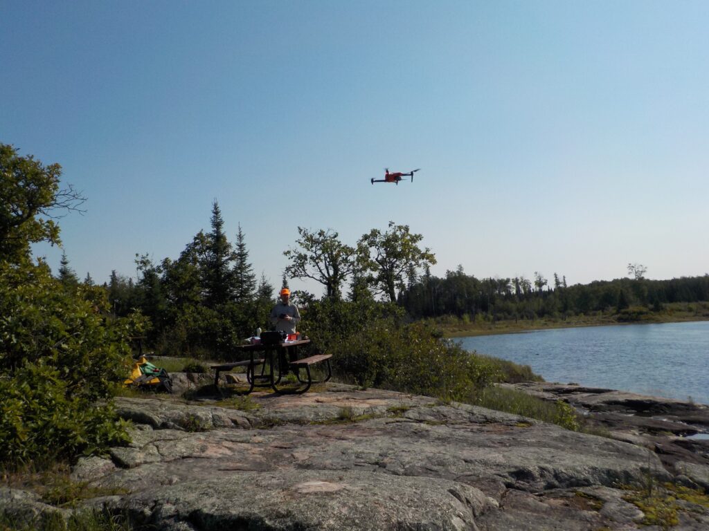
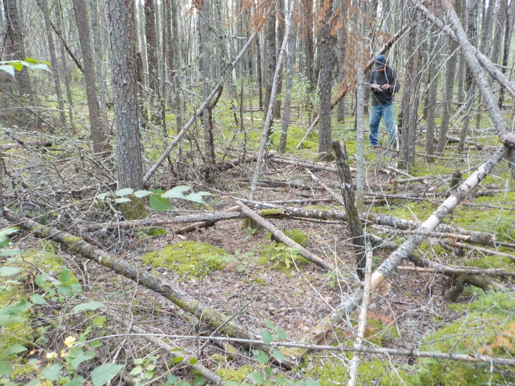
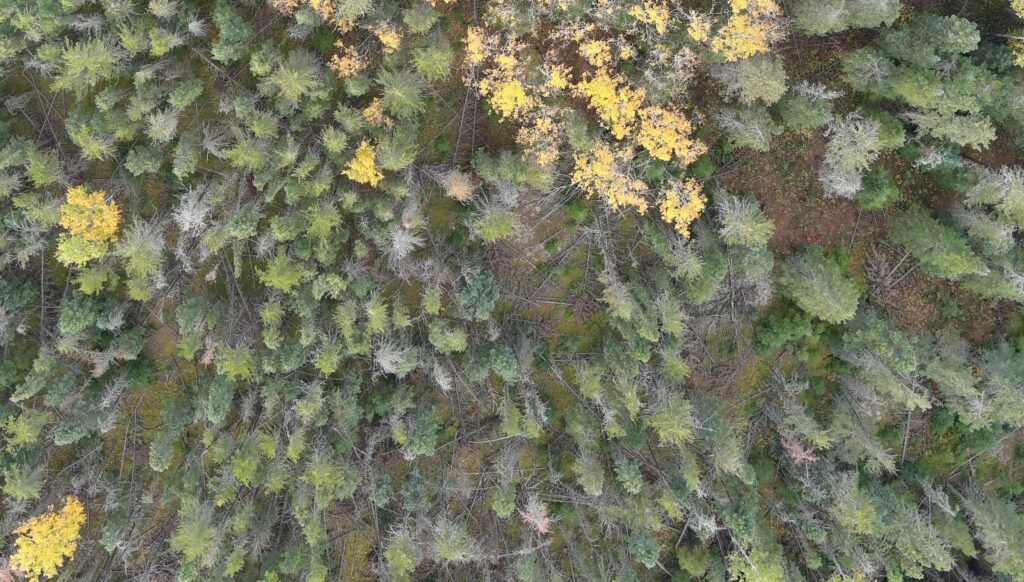
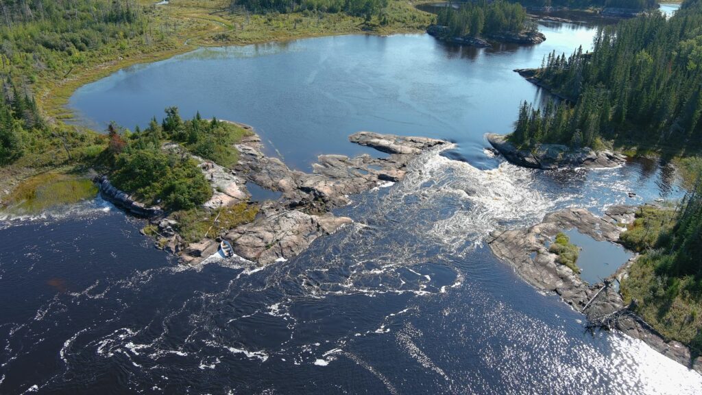
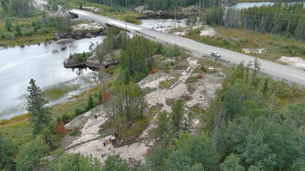
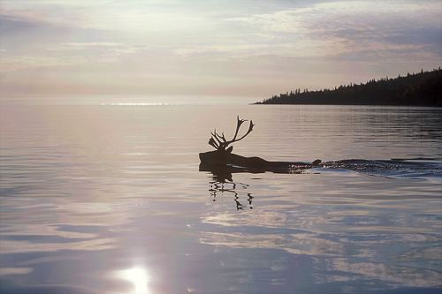
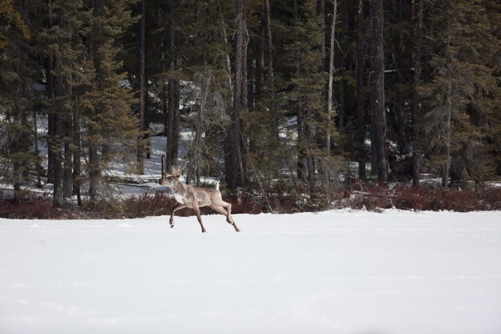
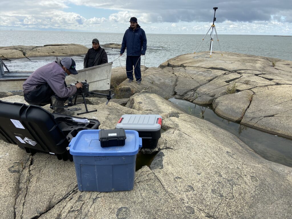
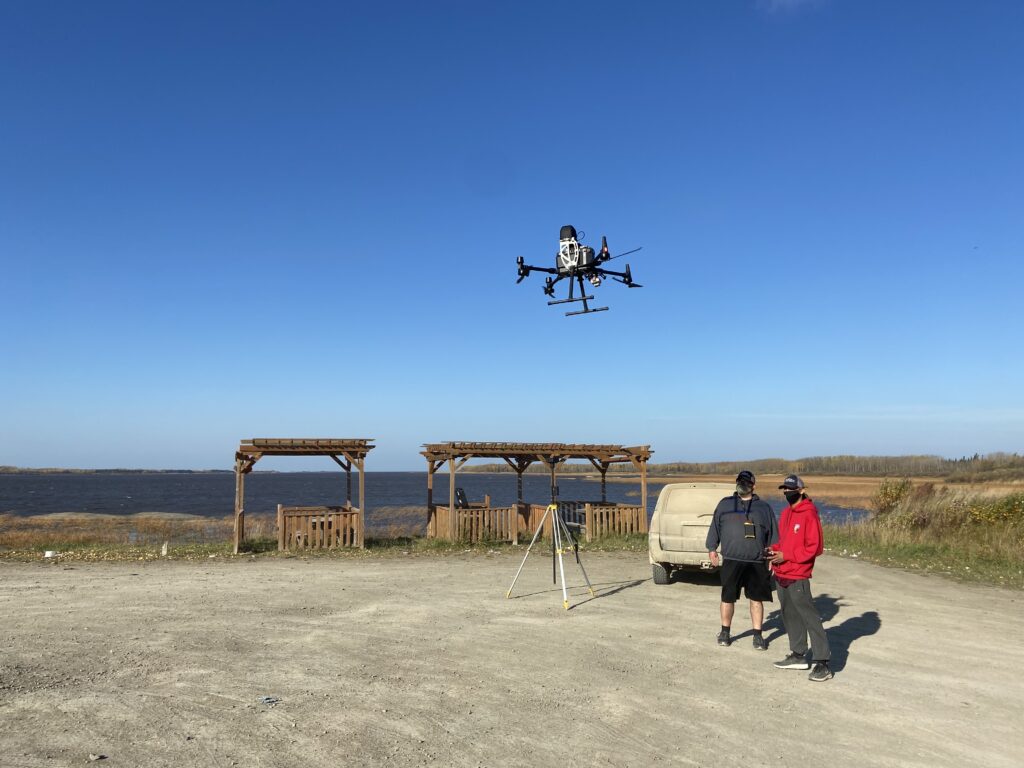
This past summer our Lands Guardian Program started a Community-Based Monitoring Project. We are collecting data using drones to monitor Lake Winnipeg algal blooms and shoreline erosion as well as testing water quality in the Poplar River that may affect fishing harvests and access to fishing grounds within Poplar River Traditional Territory.

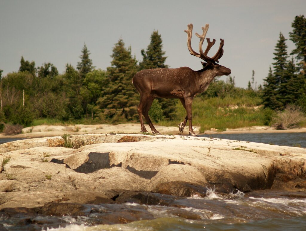
Poplar River First Nation is moving towards becoming self-reliant with monitoring lands and waters by combining both scientific methods with what is already known—Elders’ Traditional Knowledge. We understand the importance of having the best information available so we can make good decisions in regards to our lands. Poplar River First Nation also understands the importance of having our own people with skills and equipment to do this work ourselves.

The Monitoring Program will provide learning opportunities for youth from our Elders and scientists so they can continue and expand the scope of this work for years to come.

(left to right) Brad Bushie with Dennis Bittern and Norway Rabliauskas of the Poplar River First Nation Lands Guardian program.

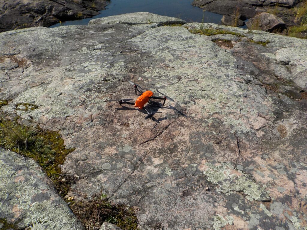
We have hired Brad Bushie as part of our Community Based Monitoring Project.

“My name is Brad Bushie. I am from Poplar River and I am 24 years old. I have been working on and off for several years with our Lands Guardian Program. I have been hired full time to work with our drone to monitor the effects of climate change. I have received my certification as a Drone Pilot with a limited licence. This means I can operate our drone in uncontrolled airspace. I have almost completed training and studying to receive my Advanced Drone Pilot Licence, which will allow me to fly the drone anywhere in Canada. I love this work. It’s good to work with our Elders and the drone is a very cool instrument; it’s like a live video game.”

Brad Bushie, Poplar River First Nation

(left to right) Tom Sutton of North/South Consultants trains Brad Bushie to use the drone.

Filed Under: Management & Protection Tagged With: algae, Elders, guardians, monitoring, Poplar River First Nation

New Eye in the Sky

December 20, 2021

Birds have always been an eye in the sky above Pimachiowin Aki. Now, thanks to drones provided by environmental consulting and research firm ECOSTEM, Pimachiowin Aki Corp. has an eye up there too. 

We are working with ECOSTEM to map land and water habitats in Pimachiowin Aki as well as tangible cultural features found mainly along major rivers in the area. At 29,000 square kilometers, Pimachiowin Aki is simply too large to ‘see’ from the ground. Each drone, and its pilot are giving us a close-up look at areas we want to know more about. 

“The project will enhance our understanding of Pimachiowin Aki and provide a baseline for monitoring,” says Pimachiowin Aki’s Executive Director. “Our monitoring program is part of how we fulfill our responsibilities as a UNESCO World Heritage site,” she adds.

Working with ECOSTEM will also allow us to bring all data we have ever collected into one place—a digital map of Pimachiowin Aki. People will be able to search the map for answers to questions like: Where do lake sturgeon spawn? What areas have been affected by wildfire? Where are the best places to find blueberries?

Drones are used to help map wildfire history, ecosystem health, and effects of climate change.

What exactly are we mapping?

Habitat Mapping  Cultural Feature Mapping
Land habitats such as forests and grasslands, wildlife habitats such as caribou calving areas Archaeological sites such as places where stone was collected to make tools
Water habitats such as rivers, wild rice, and wildlife habitat such as lake sturgeon spawning areasHarvesting sites such as hunting and fishing areas, traplines, and berry and medicine plant gathering areas
Parts that form each habitat such as plants, soil and rockCultural sites such as cabins, campsites and petroforms

Collecting Data from Soil to Sky

  • ECOSTEM collects vegetation, soil, and environmental data from plots
  • Aerial photo captured by a drone

Mapping is like taking inventory—in this case, identifying the location, number and kinds of habitats and cultural features in Pimachiowin Aki. ECOSTEM is taking inventory by going out on the land and water to collect samples and take photos and notes. The drones are capturing photos and video.

ECOSTEM Senior Ecologist Dr. James Ehnes says that the ECOSTEM drones collected “about 9,000 photos and 37 minutes of video” of Pimachiowin Aki this fall. “We had planned to capture considerably more photos and video but were unable to do so due to Covid restrictions, wildfire-related travel bans, loss of logistical support in communities that were evacuated, and extremely low water levels on rivers.”  

Once we have our complete ‘inventory,’ Pimachiowin Aki can track changes over time. This is where monitoring comes in.

Monitoring is like giving Pimachiowin Aki a regular checkup—we will compare new information with our original inventory to keep watch on Pimachiowin Aki’s natural and cultural health. This will help us make sense of any changes and predict and prepare for any threats.

Flying the drone from an island in Bloodvein River.

Project Q&A

We gained insights on the project through an interview with Dr. James Ehnes of ECOSTEM:

Your work with Pimachiowin Aki began in 2011 when you completed an ecosystem analysis to show how the area met UNESCO World Heritage criteria for outstanding universal value. What is different about the work  you are doing today?

The ‘feeling’ has changed from conducting an academic exercise to having the   opportunity to serve Pimachiowin Aki, its partner communities and local people. The work that we are now doing is focused on providing data, information, maps and other things that will support the continuation of Ji-ganawendamang Gidakiiminaan.

Pimachiowin Aki Guardians are the eyes and ears of Pimachiowin Aki. How does this project enhance their work?

Guardians can only cover a small area each year. The project immensely expands the area where information is obtained and can prioritize areas that we should go to get more information.

How are Pimachiowin Aki Guardians and Elders involved?  

Land use information from Guardians and Elders is extremely important  for cultural and natural features mapping, such as where are the best places to go to find certain plants and animals, where are notable culture features and sites located (e.g., petroforms, meeting areas, hunting areas, wild rice plantings,   controlled burns, spiritually significant areas). We hope that the information that is passed on will contribute to maintaining the memories of the people and communities.

One of two drones that ECOSTEM is using to collect photos and video in Pimachiowin Aki.

What will data you collect tell us about  Pimachiowin Aki now and over time?

Most fundamentally, it will tell us what vegetation, wetlands, landforms, waterways, etc. occur within Pimachiowin Aki at a much higher level of accuracy and detail than is available now. It will also:

  • Show a local person new places where they could to go to find things that   they want to gather or hunt  
  • Identify important habitats for species of high interest such as caribou, moose, and sturgeon
  • Aid in making reliable predictions about species that are important to local people or conservation
  • Contribute to safeguarding and recovering species of conservation concern within Pimachiowin Aki. Examples: data may result in expanded woodland caribou research and opportunities to research lake sturgeon
  • Detect and monitor the spread of invasive species
  • Show people how their traplines have been affected by wildfire
  • Identify areas that were burned more severely than usually happens—vegetation recovery may be limited, and it could be evidence that important, adverse climate change effects are happening in Pimachiowin Aki
  • Help us study how Pimachiowin Aki is responding to climate change
  • Show us areas that store the most carbon, areas that are most susceptible to releasing   greenhouse gases as the climate warms, and the best places to do climate research
  • Inform us if climate change is making fire effects worse, which has future consequences for what will be found on the land and in the water
  • Contribute to fulfilling UNESCO World Heritage monitoring requirements

How exactly do you collect information for the maps?

We collect information in two ways. We get information for the entire site from satellite imagery and information that has been created by others (e.g., elevations). We go out on the land and water in Pimachiowin Aki and take photos and notes. Sometimes we do this from planes and other times while boating or walking. While on the land, we collect plot samples and use drones to collect photos and video.

Flying the drone where the east side road meets Bloodvein River.

What is plot sampling and how is it done?

We collect habitat data in plots, sometimes with a community member and   sometimes on our own. For our work so far, this has been a 40 by 40 metre square plot. Within this plot, staff collect plant, vegetation, soils and environmental data. A botanist collects plant and vegetation data by walking through the plot and recording what they see. A soil specialist collects soil data by first digging a narrow hole about 50 cm deep, then using an auger to go down to about 100 cm and pull up material that is examined and used to describe soil conditions.

We try to leave no trace that we were there. When we’re done, we fill the hole and replace the surface ‘divot’ that was carefully removed before digging the hole.

Why has the drone collected more photos than videos?

We focused on photos because we expected that they would be more useful for creating the habitat map for the entire site. An advantage of photos is that they can be ‘stitched’ together to create an image that shows a much larger area. The stitched image from the drone is more magnified than Google Earth. We may lean more towards video when documenting cultural features along waterways or habitats for species that are especially important to local people.

How does  monitoring a habitat make it possible to reliably monitor a species?

A species’ habitat is the most important thing that determines how many individuals of that species can exist within Pimachiowin Aki, and where they are likely to be found.

Using moose as an example, areas that have burned in the past five to 15 years tend to provide considerably more moose food per hectare than other areas. If the proportion of Pimachiowin Aki area that has burned in the   past five to 15 years goes up, the number of moose can also increase.

Using sturgeon as an example, this species has very specialized conditions   for spawning. By mapping spawning conditions, we can identify areas   that should not be disturbed by human activities. We can also use the mapping to identify locations that are good candidates for restoring suitable  sturgeon spawning conditions.

See our infographic to learn more about how forest fires affect moose

Learn how to identify and protect lake sturgeon

  • Drone captured data
  • Bing satellite image

How close do the drones get to wildlife and people?

Manitoba wildlife regulations prohibit harassing wildlife, so we maintain the distance needed to avoid that, which varies with species and individuals. If we saw behaviours indicating an animal was being disturbed, we would quickly move further away. Our drones are very quiet and with the cameras we use, we don’t need to get close to an animal to see it in high detail.

We don’t intentionally get close enough to identify a person unless they have provided their consent. 

What excites you most about the project?

I’m very excited by the amount of detail that can be obtained with a drone. We can create 3D images of an area, which will be very impressive for things  such as depicting cultural or natural features on waterways.

When will the map be complete and where can I find it?

The map should be complete in 2023, following another field season in 2022.  ECOSTEM holds the data and information for the map in trust for the Pimachiowin Aki communities.  Because the map and derived products contain confidential information that belongs to the communities, they may only be used with the express and prior permission of the communities.

Photos: ECOSTEM

Filed Under: Management & Protection, Wildfire, Wildlife Tagged With: cultural sites, Elders, guardians, Mapping, monitoring, wildlife habitat

Species of Conservation Concern: Boreal Woodland Caribou

December 20, 2021

Across Canada, industrial activity and wildfires are changing forests and habitat for boreal woodland caribou. Pimachiowin Aki’s large stretch of intact boreal forest offers a rare haven for this majestic species—four groups of boreal woodland caribou live in the protected area, including one of Manitoba’s largest groups.

Boreal woodland caribou have been on the threatened species list in Manitoba since 2002. They were listed as a threatened species across Canada in 2003. 

How Pimachiowin Aki meets the needs of boreal woodland caribou

Caribou Biologist Dennis Brannen, Wildlife, Fisheries and Resource Enforcement Branch of Manitoba Agriculture and Resource Development, explains that boreal woodland caribou thrive in Pimachiowin Aki, in part, because the vast landscape allows them to avoid predators. Boreal woodland caribou inhabit Pimachiowin Aki’s remote islands, peat bogs, and mature forest, which are typically not desirable for predators like wolves and species wolves prey upon, such as moose.

“Caribou exist in older mature forested areas where there is limited food types. Wolves have less reason to go into those areas because there’s less to feed them,” explains Dennis. Caribou are able to travel more easily in Pimachiowin Aki’s deep, persistent snow and wet peat bogs compared to wolves, he adds.

Pimachiowin Aki provides boreal woodland caribou with their preferred winter foods—lichens that grow on trees and the ground, typically found in spruce, pine and tamarack forests. 

The human–predator domino effect, explained

Predators are not the root threat to Canada’s populations of boreal woodland caribou. “The general decline that we are seeing essentially comes back to human-caused landscape change,” says Dennis. Pimachiowin Aki has limited roadways and is protected from commercial mining, logging and peat extraction. In contrast, human activity across the country “has pushed the [caribou] population to the edges and restricted them to broken up patches of forests,” says Dennis.

Pimachiowin Aki is free from the adverse effects of industrial development.

When forest is broken into segments, it creates multiple issues for boreal woodland caribou. Dennis explains the domino effect.

“When forests are disturbed through human activity or natural causes like wildfire, regrowth is initially dominated by leafy shrubs, herbs and grasses—that new generation of vegetation is a surplus of food that leads to more primary prey species for wolves, such as moose.” Wolves follow and ultimately prey upon caribou, too.

Developments such as roads and trails also pose a threat. Dennis describes these linear features as “highways for predators.” They allow wolves to get into areas that were once less accessible, pick up speed, and prey on boreal woodland caribou.

Industrial development creates open areas in the forest, making boreal woodland caribou more vulnerable to predation.

Wolves are not caribou’s only predators. Other species will prey on them “when an opportunity presents itself,” says Dennis. “Across the boreal forest, black bears will prey on boreal woodland caribou calves. Out west in the Rocky Mountains, cougars prey on caribou, especially younger caribou,” he adds.   

The climate change-predator domino effect, explained 

Boreal woodland caribou travel well in wetlands. “When you bring climate change into the scenario, those wetlands become dryer,” says Dennis. In dryer times, wolves can get into those areas more efficiently. “This has implications for predation on caribou as well.”

Caribou birth rates

Another factor contributing to Canada’s declining boreal woodland caribou populations is that caribou don’t have as many young as other wildlife.

“Moose, elk and deer often have twins,” says Dennis, noting that this is rare in the caribou world. “Caribou will only have one offspring per year, so you end up in a situation where more [caribou] are being removed than added to the population in many cases.”

Ghosts of the forest—Caribou sightings in Pimachiowin Aki

Pimachiowin Aki Guardian Dennis Keeper reports seeing few caribou in Little Grand Rapids First Nation. “Fifteen to 20 years ago, we used to see hundreds and hundreds of them while traveling winter roads.” That is no longer the case. “I saw 14 of them two springs ago—a group of females. You don’t even see tracks now.”

Dennis Brannen suspects that caribou have started to avoid busier areas, like the winter roads. “Caribou are known as shadows or ghosts of the forest. They’re a secretive animal, so they don’t always show themselves when they’re around that landscape. They just shy away from where people are.”

Living with wildfire in Pimachiowin Aki

“Caribou have learned to live with fire [in Pimachiowin Aki] through time,” says Dennis Brannen. Fire is an opportunity for land to renew itself and create new and future habitats. “It’s only when we start increasing the amount of human disturbance on the landscape in combination with fire that we start seeing negative impacts on caribou populations,” he says.   

But climate change could change that, warns Dennis. “With climate change, we potentially see an impact with the size of fires and frequency and intensity of those fires on landscapes. So, there are likely to be negative impacts to available habitat and population through time.”

Pimachiowin Aki is the largest protected area in the North American boreal shield. At more than 29,000 sq. km, it provides boreal woodland caribou with room to withstand the impact of fire-related habitat loss.

The future of boreal woodland caribou

Across Canada, people are combining western and Indigenous ways of knowing to protect boreal woodland caribou and their habitat.

“Our desire is to do a better job as we move forward to bring Indigenous knowledge into caribou conservation here in Manitoba,” Dennis shares.

Manitoba’s boreal woodland caribou recovery strategy sets out goals that align with Canada’s recovery strategy. A key goal is to manage and protect boreal woodland caribou habitat to sustain populations across the land. However, results will not happen quickly.

It’s a long-term process and we have to keep that in mind,” says Dennis. “We can’t just say, okay, we’re protecting undisturbed landscape and expect caribou to start doing well tomorrow. We need to look at opportunities and ways in which we can move disturbed habitat back into a state that is suitable for boreal woodland caribou use in the future.”

Research from across Canada indicates that when a habitat is disturbed by industry, for example, it takes roughly 60 years for that habitat to become useful to caribou again.

“We are constantly reviewing developments and proposals, and looking at how they may or may not impact caribou directly,” says Dennis.

There is hope for boreal woodland caribou. Last year, it was reported that the George River population (Labrador and Quebec) increased for the first time in 25 years. That area banned hunting of caribou in 2013. However, woodland caribou are not protected across the country. Their survival is tightly woven into the long-term health of boreal ecosystems, such as those of Pimachiowin Aki.

Anishinaabeg continue to provide wildlife, including threatened species like boreal woodland caribou, with healthy habitat. Here caribou will continue to feed in both winter and summer months and find safe spaces to calve and raise their young.

Fast Facts > Boreal Woodland Caribou

Photos: Hidehiro Otake, Doug Gilmore

Filed Under: Management & Protection, Species of Conservation Concern, Wildlife Tagged With: Boreal Woodland Caribou, climate change, wildlife habitat

Boreal Woodland Caribou: Fast Facts

December 20, 2021

  • Anishinaabeg in Pimachiowin Aki generally do not hunt boreal woodland caribou—they are smaller than moose and harder to find as they are always on the move  
  • Caribou hair is hollow, providing insulation in winter and buoyancy while swimming in summer
  • Boreal woodland caribou spread out to calve alone in remote areas, unlike barren ground caribou who calve in groups of females
  • Woodland caribou have a wide-ranging lifespan of eight to fifteen years
  • Caribou are the only deer species among which both males and females have antlers
  • Male antlers are broader and larger in size. Female antlers are generally shorter and slender and typically have only one point
  • Males shed their antlers in late winter and start re-growing them in spring
  • Females shed their antlers after calving
  • Caribou make a characteristic clicking sound when they move which is caused by  tendons slipping over bones in their feet
  • Boreal woodland caribou have crescent shaped hooves that are wide and long— ideal for swimming (they act as paddles), walking on top of snow (they’re like snowshoes) and traveling across soft ground like bogs
  • Boreal woodland caribou prefer winter foods—throughout winter, they use their sharp-edged hooves to uncover and feed on Pimachiowin Aki’s abundant ground lichens
  • In summer, boreal woodland caribou thrive on Pimachiowin Aki’s diverse plant species, including grasses, lichens, shrubs and sedges
  • Boreal woodland caribou have been on the threatened species list in Manitoba since 2002. They were listed as a threatened species across Canada in 2003  
  • Four groups of boreal woodland caribou live in Pimachiowin Aki

Historical Uses for Caribou

When thousands of caribou roamed, First Nation communities hunted them for a variety of reasons:

Clothing

“Some people use the hide for clothing,” explains Pimachiowin Aki Guardian Dennis Keeper. “It’s softer than moose hide.” Antlers are used to make buttons for clothes. Caribou hides were used for moccasins (makizinan). Caribou dew claws, adikwaganzhiig, were used in ceremonial regalia.

Drum-making

“Many years ago, the only reason we would hunt caribou would be for drum-making,” Dennis Keeper says. Caribou hide is thin and makes an excellent cover for a drum.

Tools

Antlers found in the forest are used to make scrapers, needles, and knife handles. Caribou bones are used to scrape off fat from beaver, otter and moose hides.

Learn more > Species of Conservation Concern: Boreal Woodland Caribou

Feature image: Bruce Bremner

Filed Under: Indigenous Traditional Knowledge, Species of Conservation Concern, Wildlife Tagged With: Boreal Woodland Caribou, guardians

Footer

Stay connected

Sign-up for seasonal news from Pimachiowin Aki.


  • Facebook
  • Twitter
  • Instagram

  • Contact
  • Visit
  • Donate
  • Legal
  • Privacy Policy

© 2023 Pimachiowin Aki

Built by PeaceWorks