• Skip to primary navigation
  • Skip to main content
  • Skip to footer

Pimachiowin Aki

World Heritage Site

  • News
  • Resources
  • Visit
  • Home
  • Shop
  • Donate
  • Contact
  • About Us
    • Pimachiowin Aki Assembly of Partners
    • Board of Directors
    • Timeline
    • Communities
      • Bloodvein River First Nation
      • Little Grand Rapids First Nation
      • Pauingassi First Nation
      • Poplar River First Nation
    • Annual Reports
  • Keeping the Land
    • Our Work
    • Cultural Heritage
    • Wildlife and Habitat
    • Sustainable Economies
    • Guardians Program
      • Colin
      • Melba
      • Owen
      • Enil
    • Education
  • The Land That Gives Life
    • Boreal Forest
    • Calendars
    • Climate
    • Cultural Sites
    • Habitation
    • Harvesting
    • Language
    • Named Places
    • Plants
    • Travel Routes
    • Water
    • Wildfire
    • Wildlife
  • Fast Facts
  • Search
  • Facebook
  • Twitter
  • Instagram
  • YouTube

Elders

Tracing Our Roots While We Have a Chance

March 15, 2022

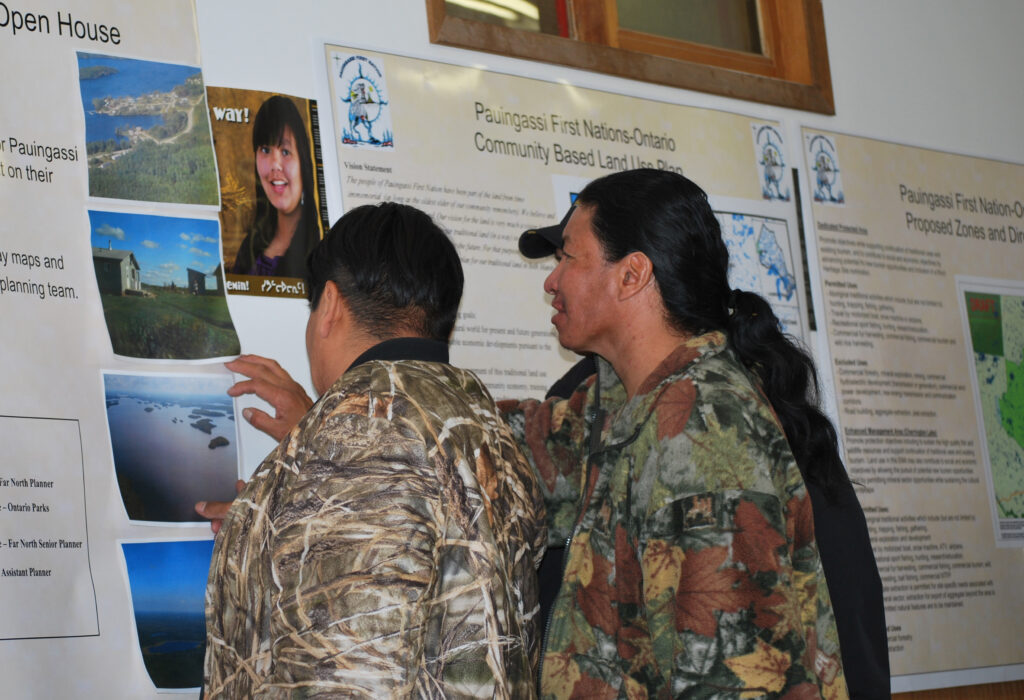
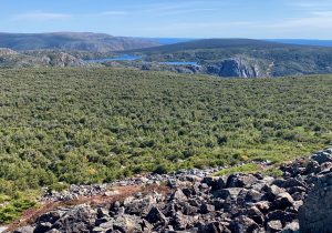
Genealogy has soared in popularity in recent years as people around the globe use DNA tests and ancestry services to understand their heritage and personal histories. One man is on a quest to learn as much as he can about the lineage of community members in Pimachiowin Aki, and says it comes with unique challenges.

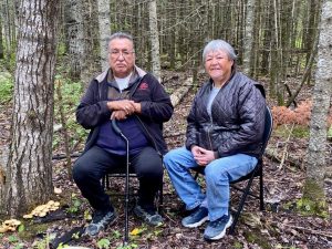
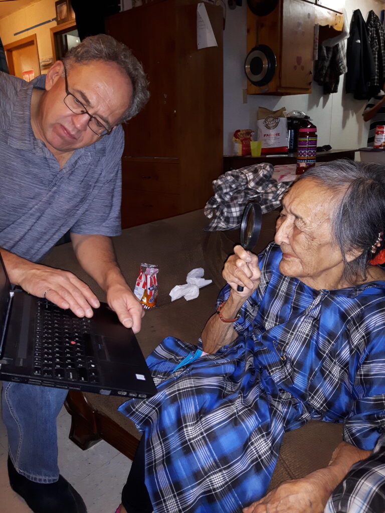
“Elders, who possess much of the knowledge, may have limited continued time with us,” cautions Gerald Neufeld (Kaahkaapish), who grew up in Pauingassi First Nation and has been working with his father Henry (Ochichaahkons) for years to help Anishinaabeg trace their roots. “Without Elders’ knowledge of history, progress in some key areas of research is at risk of coming to an end.”

Using decades-old photographs, recorded information and memories of others, Gerald is sharing and gathering as much information as possible. In an interview, he explains the importance of his work.

1. How are Elders in Pimachiowin Aki helping you with your work?

Elders usually know their family history going back at least two generations. They’re able to provide information on photographs and share knowledge of family connections from a time before photographs. For generations earlier than grandparents, my observation is that knowledge levels of ancestral history drop off.

Gerald reviews photographs with the (late) Elder Josie Strang, who enlarges the photo with her magnifying glass

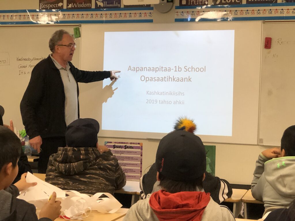
2. You and your father have given close to 75 genealogical presentations to communities and schools in Little Grand Rapids First Nation and Pauingassi First Nation over the past 30 years. Please explain how a ‘Cool Jobs’ presentation got you started.

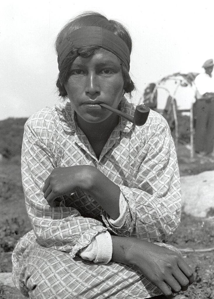
During the early ‘90s I began developing a focused interest in photos my dad had taken as well as a few Hallowell* photographs he had collected.

Omishoosh School at Pauingassi First Nation invited me to lead a presentation on employment opportunities. I had anticipated a fine, sunny day in June being an impediment to my success with the ‘Cool Jobs’ presentation, and my backup plan entailed switching to a presentation on ancestral photographs taken by my dad in the ‘50s and ‘60s. The ancestral photograph presentation was a hit! Students became immediately attentive and asked a lot of questions. From that trip, I realized that photos of Elders showed promise of something bigger. However, it took several years of tinkering with the idea before it evolved into the presentation format I currently use—a PowerPoint with well-labeled photographs.

*Alfred Irving Hallowell was an anthropologist who studied Ojibwe culture 

A slide from Gerald’s ‘One People’ presentation. Document (now out-dated) originally developed by A.I. Hallowell

3. What is the most profound or memorable experience you have had giving a presentation?

One experience that stands out is at Little Grand Rapids in October 2018. We took a lunch break during our community presentation. While doing research to prepare a response to a question, I landed on a website with a fundraiser pamphlet. It featured Hallowell photograph F052, an image of Little Grand Rapids resident Maggie Duck (Nenawan); daughter of John Duck. Feedback from Little Grand Rapids suggests she may be a daughter of Kiiwichens (John Keeper, Sr.) of Little Grand Rapids. 

Hallowell photograph F052; Maggie Duck (Nenawan) | American Philosophical Society

This sparked an interesting dialogue about rights the owners of the photograph should have versus the person photographed.

Another example took place in the Little Grand Rapids sub-office in Winnipeg. I mentioned to a former Chief that I had photographs of his grandmother and great-grandparents. He hadn’t known their names or that photographs existed. I promised to deliver him digital copies and he was very pleased!

4. What discovery stands out as most fascinating for you and families whose ancestry you have traced?

An item that is of significant interest to me is the disarray in surnames assigned by Indian Agents in 1891. Typical patrilineal (naming after the father) naming convention was not followed. Consequently, we have a mixture of names that makes it difficult for people of this region to fully understand family connections. 

When asking local people about these names, they express frustration with what appears to have been a half-hearted attempt at surname assignment which makes tracing of relatives complicated when it could be straightforward.

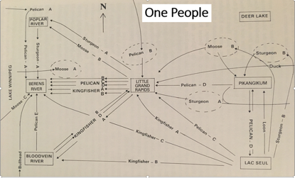
For example, the Keepers of Little Grand Rapids First Nation and the Strangs and Turtles of Pikangikum First Nation are fellow clans people—they originate from the same patriarchal head named Pasikwiikaapaw. Yet, based on my inquiries, people have limited knowledge of this.  

Surname assignment is often complicated, making it difficult to trace relatives. Example:

Shenawakoshkank—Moose Clan from Pauingassi First Nation

·     Oldest son Pishiw becomes Sandy Owen
·     Pishiw’s next youngest full brother Ochiimaaso becomes James White, Sr. 
·     Back to Sandy Owen, several sons are assigned surname Quill (Pikangikum)
·     One son is assigned Dunsford (Little Grand Rapids)
·     Many are correctly assigned Owen
·     Back to Quill, an additional name of Peters was added to some from the next generations

5. In addition to complicated surname assignment, what are the challenges of tracing ancestry in Pimachiowin Aki? 

It seems there’s no aspect of this work that provides instant results. Genealogy research is a relatively complex process. It is time intensive and requires attention to detail, but as a picture emerges, the outcome can be quite interesting.

a) Archived Treaty annuity pay-lists

Years of archived information needs to be reviewed to gain information—a review of pay-lists is necessary to identify family characteristics such as individuals’ names and years of birth.

b) Different spellings

From 1875-1891, names on Treaty annuity pay-lists were written mostly in Ojibwe. Indian Agents at the time didn’t always use the same spelling, so tracing names from one year to the next is difficult.

c) Different numbers

In early years, a Treaty reference number was assigned to heads of households where names were given. These reference numbers often changed from one year to the next, which adds an element of confusion to the research. 

d) Smudged documents

Aged documents can be difficult to read. Sometimes the writing is smudged.

e) Additional research required

When information is found, it frequently leads to more questions than answers. More research is required, such as:

  • Interviews with Elders—having knowledge of the language is an asset in some areas of this work, particularly as it relates to conversing with Elders to validate information
  • Reading history books or books written by former residents
  • Reviewing material such as Government Archives, Hudson Bay Company Archives, and Church Archives

6. What drew you to the work of recovering lost genealogical history in Pimachiowin Aki?

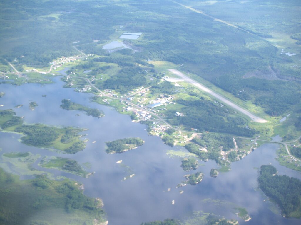
My hometown is Pauingassi First Nation. I’m intrigued about what life in the area was like long ago. 

My dad took many photographs in the ‘50s and ‘60s. Over the years I would make phone calls to people, gathering information and photographs.

What I learned about genealogy is through self-study, my memories, reading books about the region, research on the internet, and discussions with my dad. I had done some earlier work in the ‘90s, however,the first sincere efforts at understanding family connections and genealogies for Pauingassi and Little Grand Rapids areas dates to 2011. I was relatively new to this area of work.

Gerald discusses photos and family histories with Pauingassi residents Kwiiwisens (Gerald Lambert Pascal) (left) and Gerald Sonkaape (right)

7. How did you begin?

In 2010, Dad and I decided to assemble a photo album for Pauingassi First Nation. It featured nearly 300 labeled photographs that were laminated and bound into books. In 2011 we held evening meetings at Pauingassi to present the photographs by PowerPoint. Three albums were gifted to the community, one to the school, another to the Band Office, and one to the Church.

In 2017, Dad and I presented in Little Grand Rapids First Nation, Pikangikum First Nation and Poplar Hill First Nation. The presentations included Hallowell photographs along with others we had collected. We brought a colour printer and laminator to make copies of photos on request, which families could post in their houses.

8. How many presentations have you given in Pimachiowin Aki over the years?

I  estimate up to 75:

  • 25 community presentations in Little Grand Rapids First Nation and 15 in Pauingassi First Nation  
  • 25-35 school presentations. More were presented in Little Grand Rapids than in Pauingassi. This was partially due to the school at Little Grand Rapids having more classrooms   

9. What has the reception been like?

People have a genuine interest in the topic. It was clear from the levels of engagement and emotion that occasionally surfaced that we were meeting our objectives of providing valuable presentations. It seems we’ve just scratched the surface in satisfying curiosities and desires for ancestral information. Older photographs are most appealing to the audience.

10. Did school presentations lead to more discoveries?

The work my dad and I undertook was to present photos with as many identified names as possible. Teachers Aids would figure out which students were related to these photographs. Teachers Aids were also helpful in naming unidentified individuals in photographs.

11. What are the most common questions asked during your community presentations?

Recently, questions have been focused on identifying specific dates regarding education history of their parents. This is related to the need to validate their parents having attended a Day School. In March 2021, the federal government announced that eligible Indian day school students will be entitled to receive individual compensation.

Gerald gives a school presentation. The slide reads: Aapanaapita (looking back), Opasaatihkaank (Poplar Hill), Kashkatinikiisihs (the month the water freezes), 2019 tahso ahki (the year 2019)

12. Besides live presentations, how can people learn about your work?

My goal is to develop an information system that can help the people of the region understand their heritage in detail on a generation-by-generation basis. 

An information system would include a genealogical chart customized for each of the Pimachiowin Aki and other Berens River communities that portrays information on genealogical history and intermarriages between communities going back to the time of Treaty signing, and earlier where information is available. 

Each individual genealogical chart would:

  • Contain a significant amount of detail
  • Demonstrate the inter-relatedness of these communities and portray family connections between communities in this region
  • Reference photographs for individuals and their families where available

These charts could be used in the schools as well, sharing knowledge of the history of the region. Based on feedback received during presentations, this would represent a source of pride.

13. When will the information system be available?

The first charts will be several years from now at the earliest. I’m still in design stages, working at featuring the genealogical chart in a way that provides intelligence regarding in what community individuals may have been raised (giving consideration to inter-community marriages) and how to provide an easy reference to photographs featured in school hallways.

14. Do you have presentations planned for 2022?

Because of COVID, we haven’t been scheduling presentations. However, Dad and I are currently identifying names for approximately 300 photographs of people and places to be hung on the walls of Omishoosh School in Pauingassi. We’re in the early stages of identifying the names, which will be spelled phonetically, in syllabics, and English. We estimate the first names will be complete in a few months, after which Dad and I hope to schedule a trip to Pauingassi to participate in an opening ceremony for the display (Dad is 92 and so far, is healthy and could easily make such a trip).

If you have details or note any corrections to ancestral histories in this story, please contact Gerald Neufeld: gerald.neufeld4@gmail.com

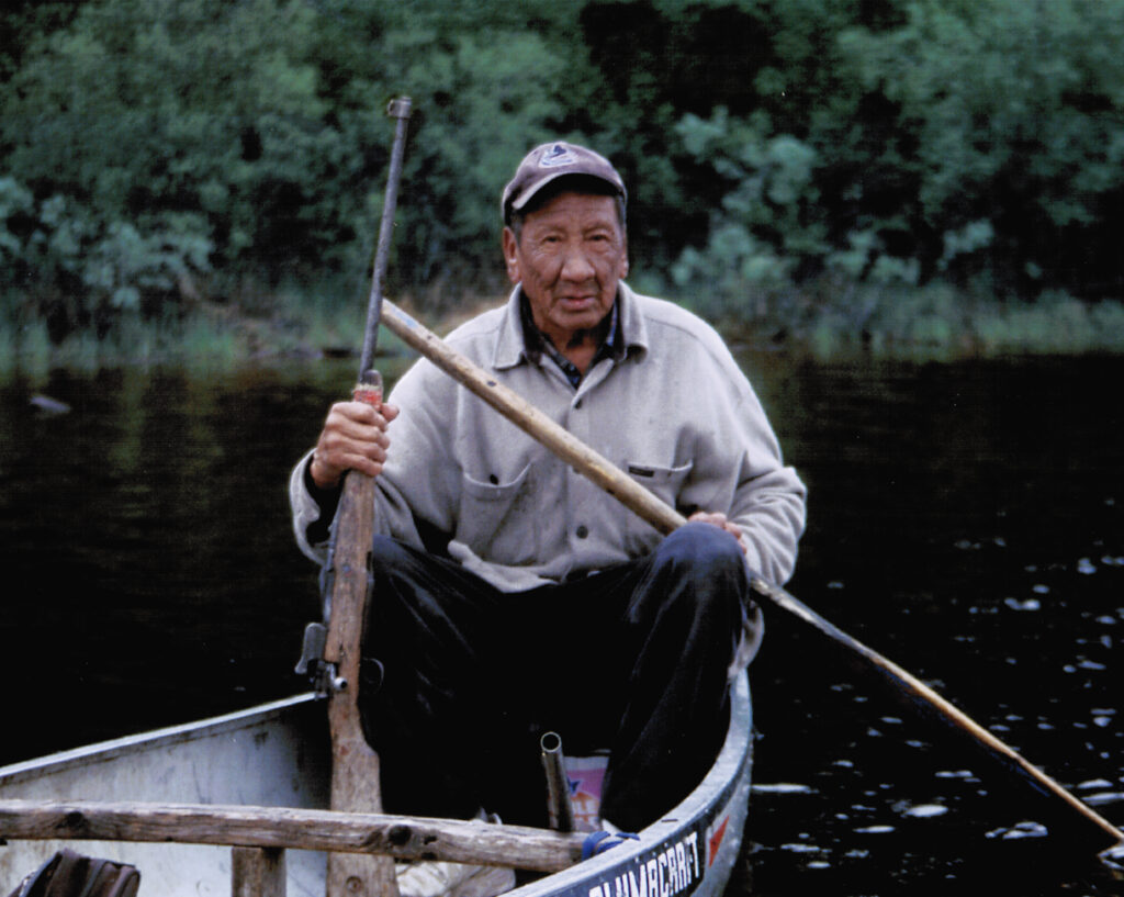
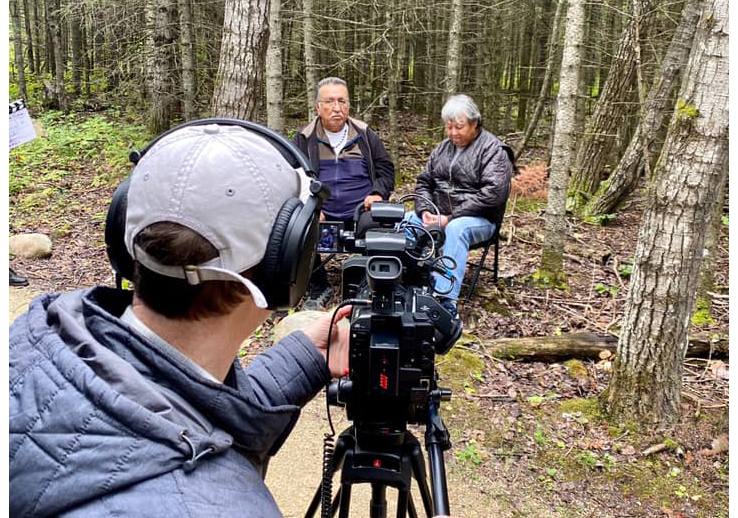
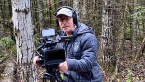
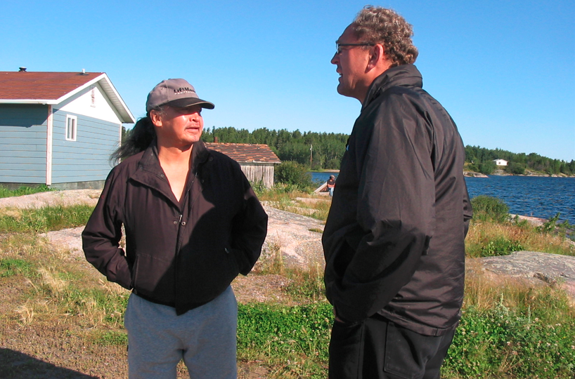
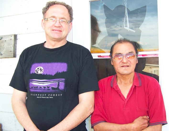
Feature image: Gerald and Taki (Albert Pascal) in Paunigassi.

Filed Under: First Nation Communities, Geneaology, Uncategorised Tagged With: Bloodvein River First Nation, Elders, Little Grand Rapids First Nation, Pauingassi First Nation, Poplar River First Nation

Community-Based Monitoring Project in Poplar River First Nation

December 20, 2021

By Ray Rabliauskas | Photos: Jesse Belle

This past summer our Lands Guardian Program started a Community-Based Monitoring Project. We are collecting data using drones to monitor Lake Winnipeg algal blooms and shoreline erosion as well as testing water quality in the Poplar River that may affect fishing harvests and access to fishing grounds within Poplar River Traditional Territory.

Poplar River First Nation is moving towards becoming self-reliant with monitoring lands and waters by combining both scientific methods with what is already known—Elders’ Traditional Knowledge. We understand the importance of having the best information available so we can make good decisions in regards to our lands. Poplar River First Nation also understands the importance of having our own people with skills and equipment to do this work ourselves.

The Monitoring Program will provide learning opportunities for youth from our Elders and scientists so they can continue and expand the scope of this work for years to come.

(left to right) Brad Bushie with Dennis Bittern and Norway Rabliauskas of the Poplar River First Nation Lands Guardian program.

We have hired Brad Bushie as part of our Community Based Monitoring Project.

“My name is Brad Bushie. I am from Poplar River and I am 24 years old. I have been working on and off for several years with our Lands Guardian Program. I have been hired full time to work with our drone to monitor the effects of climate change. I have received my certification as a Drone Pilot with a limited licence. This means I can operate our drone in uncontrolled airspace. I have almost completed training and studying to receive my Advanced Drone Pilot Licence, which will allow me to fly the drone anywhere in Canada. I love this work. It’s good to work with our Elders and the drone is a very cool instrument; it’s like a live video game.”

Brad Bushie, Poplar River First Nation

(left to right) Tom Sutton of North/South Consultants trains Brad Bushie to use the drone.

We are happy to share and highlight the work of our very competent Lands Guardians’ Team. As a community, we are very proud of these young people and the work they do.

Poplar River First Nation Lands Program

The following report summarizes the main field activities conducted and data collected during year two of the project:

Poplar River First Nation CBM-Year 2-Report_02Download

Filed Under: Management & Protection Tagged With: algae, Elders, guardians, monitoring, Poplar River First Nation

New Eye in the Sky

December 20, 2021

Birds have always been an eye in the sky above Pimachiowin Aki. Now, thanks to drones provided by environmental consulting and research firm ECOSTEM, Pimachiowin Aki Corp. has an eye up there too. 

We are working with ECOSTEM to map land and water habitats in Pimachiowin Aki as well as tangible cultural features found mainly along major rivers in the area. At 29,000 square kilometers, Pimachiowin Aki is simply too large to ‘see’ from the ground. Each drone, and its pilot are giving us a close-up look at areas we want to know more about. 

“The project will enhance our understanding of Pimachiowin Aki and provide a baseline for monitoring,” says Pimachiowin Aki’s Executive Director. “Our monitoring program is part of how we fulfill our responsibilities as a UNESCO World Heritage site,” she adds.

Working with ECOSTEM will also allow us to bring all data we have ever collected into one place—a digital map of Pimachiowin Aki. People will be able to search the map for answers to questions like: Where do lake sturgeon spawn? What areas have been affected by wildfire? Where are the best places to find blueberries?

Drones are used to help map wildfire history, ecosystem health, and effects of climate change.

What exactly are we mapping?

Habitat Mapping  Cultural Feature Mapping
Land habitats such as forests and grasslands, wildlife habitats such as caribou calving areas Archaeological sites such as places where stone was collected to make tools
Water habitats such as rivers, wild rice, and wildlife habitat such as lake sturgeon spawning areasHarvesting sites such as hunting and fishing areas, traplines, and berry and medicine plant gathering areas
Parts that form each habitat such as plants, soil and rockCultural sites such as cabins, campsites and petroforms

Collecting Data from Soil to Sky

  • ECOSTEM collects vegetation, soil, and environmental data from plots
  • Aerial photo captured by a drone

Mapping is like taking inventory—in this case, identifying the location, number and kinds of habitats and cultural features in Pimachiowin Aki. ECOSTEM is taking inventory by going out on the land and water to collect samples and take photos and notes. The drones are capturing photos and video.

ECOSTEM Senior Ecologist Dr. James Ehnes says that the ECOSTEM drones collected “about 9,000 photos and 37 minutes of video” of Pimachiowin Aki this fall. “We had planned to capture considerably more photos and video but were unable to do so due to Covid restrictions, wildfire-related travel bans, loss of logistical support in communities that were evacuated, and extremely low water levels on rivers.”  

Once we have our complete ‘inventory,’ Pimachiowin Aki can track changes over time. This is where monitoring comes in.

Monitoring is like giving Pimachiowin Aki a regular checkup—we will compare new information with our original inventory to keep watch on Pimachiowin Aki’s natural and cultural health. This will help us make sense of any changes and predict and prepare for any threats.

Flying the drone from an island in Bloodvein River.

Project Q&A

We gained insights on the project through an interview with Dr. James Ehnes of ECOSTEM:

Your work with Pimachiowin Aki began in 2011 when you completed an ecosystem analysis to show how the area met UNESCO World Heritage criteria for outstanding universal value. What is different about the work  you are doing today?

The ‘feeling’ has changed from conducting an academic exercise to having the   opportunity to serve Pimachiowin Aki, its partner communities and local people. The work that we are now doing is focused on providing data, information, maps and other things that will support the continuation of Ji-ganawendamang Gidakiiminaan.

Pimachiowin Aki Guardians are the eyes and ears of Pimachiowin Aki. How does this project enhance their work?

Guardians can only cover a small area each year. The project immensely expands the area where information is obtained and can prioritize areas that we should go to get more information.

How are Pimachiowin Aki Guardians and Elders involved?  

Land use information from Guardians and Elders is extremely important  for cultural and natural features mapping, such as where are the best places to go to find certain plants and animals, where are notable culture features and sites located (e.g., petroforms, meeting areas, hunting areas, wild rice plantings,   controlled burns, spiritually significant areas). We hope that the information that is passed on will contribute to maintaining the memories of the people and communities.

One of two drones that ECOSTEM is using to collect photos and video in Pimachiowin Aki.

What will data you collect tell us about  Pimachiowin Aki now and over time?

Most fundamentally, it will tell us what vegetation, wetlands, landforms, waterways, etc. occur within Pimachiowin Aki at a much higher level of accuracy and detail than is available now. It will also:

  • Show a local person new places where they could to go to find things that   they want to gather or hunt  
  • Identify important habitats for species of high interest such as caribou, moose, and sturgeon
  • Aid in making reliable predictions about species that are important to local people or conservation
  • Contribute to safeguarding and recovering species of conservation concern within Pimachiowin Aki. Examples: data may result in expanded woodland caribou research and opportunities to research lake sturgeon
  • Detect and monitor the spread of invasive species
  • Show people how their traplines have been affected by wildfire
  • Identify areas that were burned more severely than usually happens—vegetation recovery may be limited, and it could be evidence that important, adverse climate change effects are happening in Pimachiowin Aki
  • Help us study how Pimachiowin Aki is responding to climate change
  • Show us areas that store the most carbon, areas that are most susceptible to releasing   greenhouse gases as the climate warms, and the best places to do climate research
  • Inform us if climate change is making fire effects worse, which has future consequences for what will be found on the land and in the water
  • Contribute to fulfilling UNESCO World Heritage monitoring requirements

How exactly do you collect information for the maps?

We collect information in two ways. We get information for the entire site from satellite imagery and information that has been created by others (e.g., elevations). We go out on the land and water in Pimachiowin Aki and take photos and notes. Sometimes we do this from planes and other times while boating or walking. While on the land, we collect plot samples and use drones to collect photos and video.

Flying the drone where the east side road meets Bloodvein River.

What is plot sampling and how is it done?

We collect habitat data in plots, sometimes with a community member and   sometimes on our own. For our work so far, this has been a 40 by 40 metre square plot. Within this plot, staff collect plant, vegetation, soils and environmental data. A botanist collects plant and vegetation data by walking through the plot and recording what they see. A soil specialist collects soil data by first digging a narrow hole about 50 cm deep, then using an auger to go down to about 100 cm and pull up material that is examined and used to describe soil conditions.

We try to leave no trace that we were there. When we’re done, we fill the hole and replace the surface ‘divot’ that was carefully removed before digging the hole.

Why has the drone collected more photos than videos?

We focused on photos because we expected that they would be more useful for creating the habitat map for the entire site. An advantage of photos is that they can be ‘stitched’ together to create an image that shows a much larger area. The stitched image from the drone is more magnified than Google Earth. We may lean more towards video when documenting cultural features along waterways or habitats for species that are especially important to local people.

How does  monitoring a habitat make it possible to reliably monitor a species?

A species’ habitat is the most important thing that determines how many individuals of that species can exist within Pimachiowin Aki, and where they are likely to be found.

Using moose as an example, areas that have burned in the past five to 15 years tend to provide considerably more moose food per hectare than other areas. If the proportion of Pimachiowin Aki area that has burned in the   past five to 15 years goes up, the number of moose can also increase.

Using sturgeon as an example, this species has very specialized conditions   for spawning. By mapping spawning conditions, we can identify areas   that should not be disturbed by human activities. We can also use the mapping to identify locations that are good candidates for restoring suitable  sturgeon spawning conditions.

See our infographic to learn more about how forest fires affect moose

Learn how to identify and protect lake sturgeon

  • Drone captured data
  • Bing satellite image

How close do the drones get to wildlife and people?

Manitoba wildlife regulations prohibit harassing wildlife, so we maintain the distance needed to avoid that, which varies with species and individuals. If we saw behaviours indicating an animal was being disturbed, we would quickly move further away. Our drones are very quiet and with the cameras we use, we don’t need to get close to an animal to see it in high detail.

We don’t intentionally get close enough to identify a person unless they have provided their consent. 

What excites you most about the project?

I’m very excited by the amount of detail that can be obtained with a drone. We can create 3D images of an area, which will be very impressive for things  such as depicting cultural or natural features on waterways.

When will the map be complete and where can I find it?

The map should be complete in 2023, following another field season in 2022.  ECOSTEM holds the data and information for the map in trust for the Pimachiowin Aki communities.  Because the map and derived products contain confidential information that belongs to the communities, they may only be used with the express and prior permission of the communities.

Photos: ECOSTEM

Filed Under: Management & Protection, Wildfire, Wildlife Tagged With: cultural sites, Elders, guardians, Mapping, monitoring, wildlife habitat

Land Management Plans: Protecting Pimachiowin Aki

June 13, 2021

Frank Duck sits in canoe with a paddle and gun in hand.

Twenty years ago, First Nation communities of Pimachiowin Aki formed a partnership to support each other in protecting ancestral lands. The vision and commitment are set out in the Protected Areas and First Nation Resource Stewardship: A Cooperative Relationship Accord (the Accord). The Accord recognizes formal protected area planning processes led by Anishinaabeg, which became the foundation of the Pimachiowin Aki World Heritage Site. Elders provided the vision for the plans, based on traditional harvesting areas of Anishinaabe families associated with customary stewardship and governance.

Today there are six community-led plans in Pimachiowin Aki that govern land use and decision-making and guide the work of the Guardians. These are the first plans of their kind to be completed in Manitoba, and the third in Ontario.

Community Review: Poplar River First Nation Land Management Plan

Asatiwisipe Aki Management Plan – Poplar River First Nation

Developed out of respect for “our ancestors who loved and cherished this land and cared for it for centuries to ensure all future generations would have life” and to “keep the land in its natural beauty as it was created”, the plan provides for the protection of the entire 8,620 square-kilometre Poplar River First Nation traditional territory.

Planning Meeting: Bloodvein River First Nation

Pimitotah – To Care for Our Land (Bloodvein First Nation)

This plan is dedicated to the Bloodvein River Elders “for sharing their knowledge of the land and resources within our traditional area, and for their help and guidance”. Protection and management of the 3,916 square kilometre traditional territory is guided by a commitment “to look after and take care of the habitat and living things that use this land. To have water that is safe for all living things. To have land that has not been disturbed by industrial development. To smell the fresh air that is free from pollutants.  Protection means we will ensure that if economic development takes place, it will be respectful of the land and all life that exists on the land.”

Open House: Little Grand Rapids First Nation

Ni-Kes Lands Management Plan – Little Grand Rapids First Nation (Manitoba)

Little Grand Rapids First Nation Community-Based Land Use Plan (Ontario)

With ancestral lands in both provinces of Manitoba and Ontario, the Little Grand Rapids First Nation completed two land management plans. The plans are “dedicated to the memory of Ni-Kes (Frank Duck), an esteemed Elder, whose knowledge and way of life continue to be an inspiration to the Little Grand Rapids Anishinaabeg”. The plans provide for the protection and management of lands and waters, continued traditional use, and support community-led sustainable economic development opportunities in the 6,612 square-kilometre Little Grand Rapids First Nation traditional territory.

Open House: Pauingassi First Nation

Naamiwan: The Land of Fair Wind Lands Management Plan – Pauingassi First Nation (Manitoba)

Pauingassi First Nation Community Based Land-Use Plan (Ontario)

Pauingassi First Nation has ancestral lands in both provinces of Manitoba and Ontario, and two land management plans. The plans are “dedicated to the memory of Naamiwan (Fair Wind), a renowned medicine man and healer, whose dream, drum and the ceremonies he conducted illustrate the important role of traditional Anishinaabe knowledge, practices and beliefs in land management and protection to this day.”

The plans provide legal protection of lands and waters while supporting potential sustainable economic development opportunities. In finding this balance, the Pauingassi land management plans are contributing to a stronger future for the community. The combined Pauingassi First Nation traditional territory is 4,525 square kilometres in area.

The Pimachiowin Aki Management Plan

The Pimachiowin Aki Corporation participates in implementation of the community-led plans to ensure the area’s Outstanding Universal Value continues to be protected. A Pimachiowin Aki Management Plan was developed by the partners as a unifying document, integrating customary governance and legal prescriptions across the site. This site-level management plan draws its primary direction from the First Nations’ Accord to protect and care for Pimachiowin Aki as a sacred duty and trust to future generations.

Bloodvein River First Nation

Feature photo: Ni-Kes (Frank Duck), Little Grand Rapids First Nation

Filed Under: First Nation Communities, Management & Protection Tagged With: Bloodvein River First Nation, Elders, Land management plans, Little Grand Rapids First Nation, Pauingassi First Nation, Poplar River First Nation

Grandpa’s Story: Gwiigwiishiwag

March 15, 2021

Whiskey Jack bird in tree.
Gwiigwiishiwag (Photo: Christian Artuso)

When I was out as a young boy with my slingshot, my Grandpa always told me not to bother Canada Jays, Gwiigwiishiwag, because they help moose hunters find moose. My Grandpa would talk to that bird, and they would understand him. Whichever direction the bird flies, he would go hunting for the day. Most of the time he was successful. My Grandpa would feed Gwiigwiishiwag, except before he went hunting. After Gwiigwiishi would show him the way, he would feed that bird, not one particular bird, but the one that showed him the way that day.”

—Little Grand Rapids First Nation Guardian Dennis Keeper tells his Grandpa’s story  

Filed Under: Birds, Cultural Heritage, Traditional Story, Wildlife Tagged With: Canada Jay, Elders, guardians

A Little Paper Creates a Big Problem

December 10, 2020

At eight years old, Michael Zelniker had no problem admonishing adults to stop littering in the streets of Montréal. Today, his dedication to protecting the environment has grown into a quest to protect the boreal forest for future generations.

The Issue with Tissue

“Tissue companies are flushing away our forests and our future,” warns the filmmaker from his Los Angeles home. 

‘The Issue with Tissue’ is the title of his latest project—a film to let the world know that “the boreal forest is being clear cut so we can wipe our bums with softer, more plush toilet paper.”

Michael was shocked when he first learned that one of the most ecologically important forests in the world—Canada’s boreal forest—is being destroyed to make toilet paper.

“What we do to each other, we do to ourselves; what we do to the land, we do to ourselves,” he says. 

Who is Affected?

There’s more to the boreal forest than just trees. The boreal forest plays an important role in slowing the effects of climate change. It stores almost twice as much carbon as tropical forests and has more surface freshwater than any other ecosystem on the planet. 

“I discovered that more than 600 First Nations call the boreal forest home and have for thousands of years; that the boreal is home to caribou and other wildlife. It is the nesting ground for the songbirds we hear in our parks and our backyards.” Michael’s backyard is in California but as a child growing up in Montréal, he went to summer camp 100 miles north at the southern edge of the boreal forest.

“I hated camp. I was a troubled kid and as a result, I was always in trouble,” he remembers. He discovered his love of nature during this otherwise unhappy camp experience.

“The breathtaking view of endless forest was the one thing that comforted me at camp.” It forged in him a deep lifelong connection to trees. “When I’m in a forest today, I feel like I’m with long-lost family.”

While researching the toilet paper issue, Michael spent dozens of hours on Zoom talking with scientists, activists, and First Nation leaders. “Everyone opened their hearts and shared their story with me,” he says. It was an incredible privilege, he adds.

Inspired by the conversations, Michael knew he had to share the untold story with the world.

Lessons from Indigenous Elders and Leaders

“I began to feel, ‘If not me, then who? If not now, then when?’”

Elder Leslie Orvis Sr. and William Young

Those two questions led to an inspiring filmmaking experience. Michael collected over 100 hours of footage as he traveled across Canada to interview First Nation Elders and leaders, including Bloodvein River First Nation Elder Leslie Orvis Sr. and Pimachiowin Aki Board Director William Young.

His journey began in BC with Canadian cameraperson Abanoub Andraous. The two of them drove, with multiple stops along the way, to Eastern Quebec where they flew north by bush plane to the George River. There, they met with Valérie Courtois, Director of the Indigenous Leadership Initiative, and Innu as they celebrated the migration of the caribou. “It was a profoundly moving experience,” Michael says enthusiastically.

He describes the entire filmmaking experience as “eye-opening and life-changing.” He hopes the film will have a strong impact on others, much like the journey has had on him.

“I had so many special moments filming,” Michael says. He was touched by the hospitality and generosity of the people that he got to visit and talk with. “I felt deeply honoured.”

“What has caused us to go so wrong as a species?” he asks. Learning from First Nation Elders and leaders, Michael says that we have lost connection to the land and with each other. “As a result, settler colonial types like me look at how to value land based on dollars and cents, and as a way to exploit rather than as a member of our family.”

Elder Dave Porter of Kaska First Nation in northern British Columbia shared his wisdom with Michael. “Mother Nature, since the beginning of time, takes care of us because Mother Earth has provided us this environment to live so well. If we don’t begin to take better care of Mother Nature, we’re going to destroy her ability to take care of us.”

Elder Porter also told Michael that “when you’re in a forest, you’re with family.” Michael heard similar themes from others across the country.  

Chief Darrell Bob of the Xaxli’p Community in Lillooet, BC invited Michael into his sweat lodge. “He pointed to the stones that warmed the sweat lodge and said, ‘These are our grandfathers.’”

The lessons continued as Michael met with Elder Dave Courchene from Turtle Lodge in Sagkeeng First Nation in Manitoba. He explained about natural law—to only take as much as you need.

“Give thanks to what you take with an eye for the seven generations in front of you,” explains Michael. He had never heard this lesson until he met with Indigenous people.

“In American white culture we believe that a lot is good, more is better, and too much is just right. And we see it even with the pandemic—what were people hoarding? Toilet paper.”

After his footage comes together and is shared with the world, Michael hopes that North Americans will make the connection between trees and paper products like toilet paper, and become “more mindful of how we’re using them.”

He recalls a memorable statement that Elder Courchene made to him, and it is a mighty ask: “If you can do one thing, get them to give us back the boreal and we can take care of the rest.”

Imagine the possibilities if that were the result.

Here are ways that Michael suggests for you to make a difference:

  • Buy recycled paper products made from post consumer content
  • Buy wood, pulp & paper products with the FSC certification seal
  • Whenever possible, stop using single use disposables—use reusables
  • Demand that governments fulfill their commitments to Indigenous Peoples to protect/conserve their ancestral home­—the land, air and water—the animals, plants and trees that inhabit these wild spaces
  • Support the establishment of Indigenous Protected and Conserved Areas (IPCA)
  • Spend time in nature. Bring your child to wild spaces. Connect with the other creatures, the trees, plants, and animals that make up Mother Earth’s creation. They are all members of our wider family. Treat them as such
  • Support First Nation Guardian Programs

Michael Zelniker is a Canadian-born award-winning actor/director based in Los Angeles. He is a member of the Climate Reality Project Leadership Corps (led by former U.S. Vice President Al Gore), serving as Co-Chair of the Los Angeles Chapter. His film, ‘The Issue with Tissue’, is set for release in 2021. We will keep you posted on its release date and how/where to watch it.

Filed Under: Boreal Forest, First Nation Communities, Indigenous Traditional Knowledge Tagged With: Bloodvein River First Nation, Elders, Michael Zelnicker, The issue with tissue

  • Go to page 1
  • Go to page 2
  • ⟩

Footer

Stay connected

Sign-up for seasonal news from Pimachiowin Aki.


  • Facebook
  • Twitter
  • Instagram
  • YouTube

  • Contact
  • Visit
  • Shop
  • Donate
  • Legal
  • Privacy Policy

© 2025 Pimachiowin Aki

Built by PeaceWorks